Drone Photogrammetry: Mastering Construction Site Volumes
You have probably stood there, looking at a mountain of soil or gravel on your site.
You know you need an accurate volume number, and you need it now.
The old way of doing things just feels slow and often leaves you guessing.
We have all felt that frustration of waiting days for a survey report, only to question whether it is accurate.
This delay can bring your whole project to a grinding halt.
You need a better way to make informed decisions based on current site data.
Modern job sites are turning to drone photogrammetry for construction site volume calculations because it changes everything.
It offers speed, accuracy, and safety that older methods just cannot match.
You are about to learn how this technology works and why it has become the new standard for measuring materials and helping to track progress on earthwork.
Ready to view your construction project from new heights?
Contact 1st Choice Aerials today to schedule your aerial photography, inspection, or thermal imaging service!
On This Page:
What Exactly Is Drone Photogrammetry?
At its heart, aerial photogrammetry is the science of making measurements from photographs.
Imagine taking hundreds, or even thousands, of overlapping images of a stockpile from multiple angles.
Then, you use smart software to stitch all those pictures together to create detailed models.
The software identifies common points in the captured photos.
It uses this point cloud data to build a mathematically precise, three-dimensional model of the area.
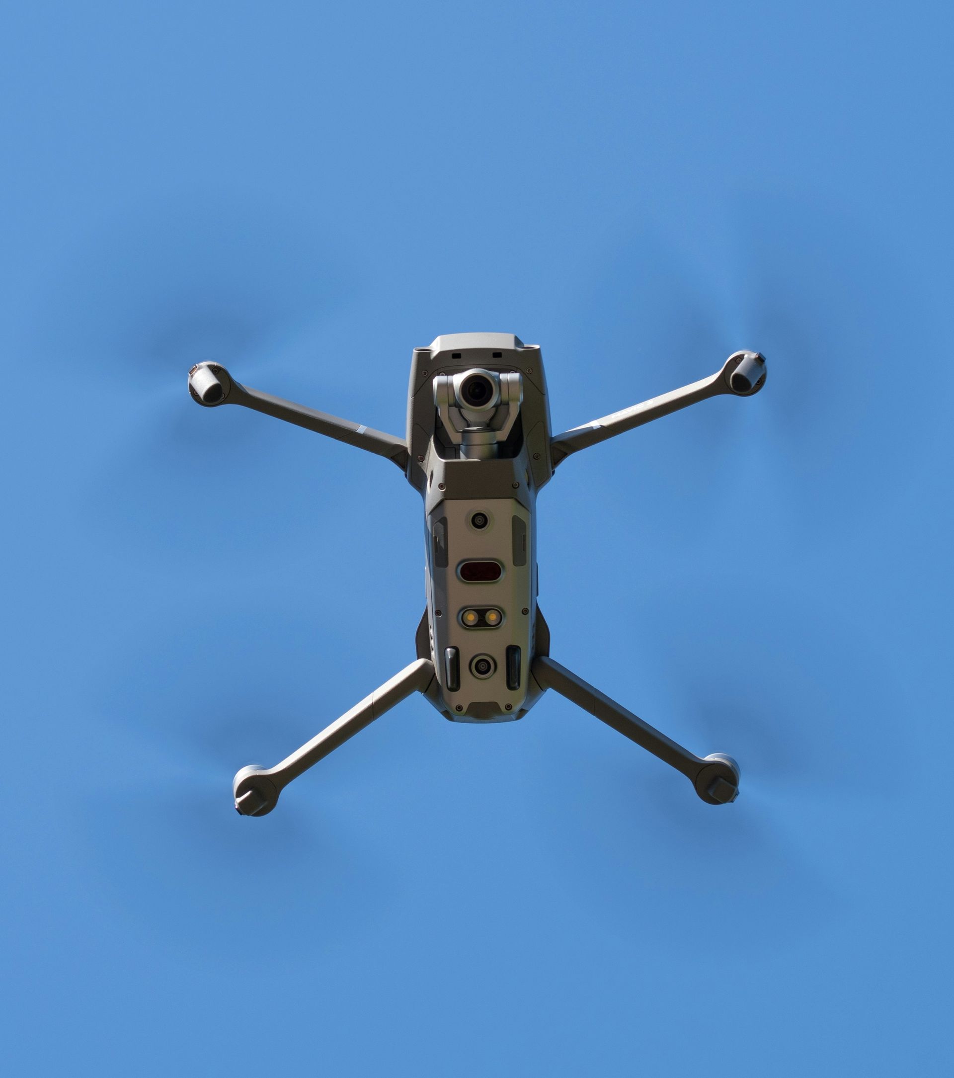
An unmanned aerial vehicle is perfect for this because it can fly a pre-programmed, grid-like path over your site, capturing high-resolution images systematically to gather data.
This process creates much more than just a pretty picture.
The key outputs for construction are a detailed point cloud, digital surface models (DSMs), and a terrain model.
These are the digital twins of your site, from which you can pull all sorts of valuable survey data, especially for calculating volumes.
Why Traditional Volume Calculations Fall Short
For decades, the standard method for measuring a stockpile was to send a survey crew out with a GPS rover for land surveying.
They would walk the pile, taking individual measurements at the top, bottom, and at various points in between.
This manual process has some serious drawbacks that you have likely experienced firsthand.
First, it is incredibly slow compared to modern data collection.
A survey team could spend half a day or more walking a single large stockpile.
Then you have to wait more for them to process the data and send back a report, delaying critical project decisions.
Second, it is often inaccurate because a crew can only physically capture so many points.
Because of this, they are making big assumptions about what the surface of the pile looks like between those points, a process known as interpolation.
A study on stockpile measurement found that traditional methods can be significantly less precise than aerial methods.
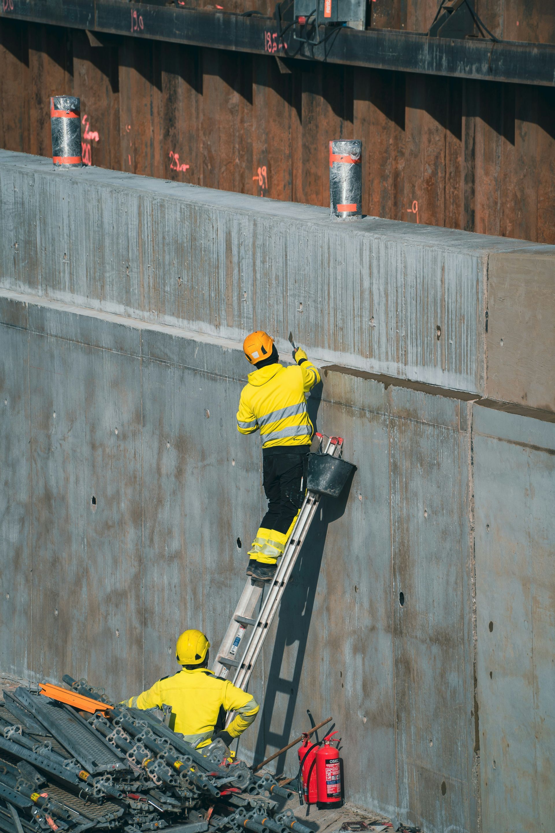
Finally, it poses a safety risk and can increase the environmental impact through site disturbance.
Having people climb over loose, unstable piles of material is an accident waiting to happen.
The New Standard: Using Drone Photogrammetry for Construction Site Volume Calculations
Now, compare that old method to the drone-based approach.
The difference is like night and day.
What used to take a team of people half a day can now be done by a single drone pilot in under an hour.
This shift not only saves time but also gives you aerial data that is far more reliable.
The workflow is straightforward and efficient.
It breaks down into a few clear steps, moving from flight planning to getting your final, actionable numbers.
Step 1: Planning the Flight
This is the most important step for getting accurate results.
Before the unmanned aerial vehicle even takes off, the pilot plans the mission using specialized flight planning software.
This planning software involves defining the exact area to be surveyed for the mapping construction project.
The pilot also sets the flight altitude and the amount of image overlap.
A higher overlap, typically 70-80 percent, gives the software more data to work with, leading to a more accurate 3D model.
Better software capture leads to better final results.
To get survey-grade accuracy, the pilot will also place Ground Control Points (GCPs) on the site.
These are marked targets whose exact coordinates are measured with a high-precision GPS unit.
When the drone data is processed, it is tied to these known points of ground control, correcting for any minor GPS drift and locking the model to your site's coordinate system.
This step is critical for repeatable and highly accurate measurements over time, forming the foundation of good survey mapping.
Some advanced drone hardware uses RTK or PPK technology to reduce the need for as many GCPs, but placing a few for verification is still best practice.
This attention to detail is what separates a pretty picture from professional survey data.
Step 2: Flying the Drone

Once the plan is set, the actual flight is mostly automated.
A mapping drone takes off and follows the pre-programmed flight path.
The aerial vehicle will capture hundreds or thousands of geo-tagged images during its flight.
The pilot's job is to monitor the unmanned aerial system and make sure the operation is conducted safely.
A typical flight over a few stockpiles might only take 20 to 30 minutes.
The drone's camera captures everything with amazing detail, creating a highly detailed visual record of the site conditions.
This complete coverage eliminates the guesswork inherent in manual surveys.
The data collection process is comprehensive and systematic.
Every square foot of the target area is documented with high-resolution imagery.
Step 3: Processing the Data
After the flight, the images are uploaded to a powerful photogrammetry software platform for data processing.
This is where the digital magic happens.
The software will process data by analyzing the images, identifying millions of common tie points, and constructing a 3D point cloud.
This initial photogrammetry stage is computationally intensive but foundational for all other outputs.
From the detailed point cloud, a 3D textured mesh and a high-resolution orthomosaic map are created.
This cloud data can be shared with various team members through online platforms.
The orthomosaic map is like a satellite image, but with much higher detail and no distortion.
The 3D mesh is the virtual representation of your site that you can measure from any angle.
It is an incredibly detailed digital asset for project management.
Step 4: Calculating the Volumes
With the 3D model created, calculating volumes is simple.
You use software extraction tools to draw a boundary around the base of the stockpile.
This defines the "bottom" surface of your measurement, which can be a flat plane or the actual pre-existing terrain.
The software then compares this base plane to the millions of data points making up the top surface of the stockpile.
It calculates the volume between these two surfaces with incredible precision.
The process involves classifying points as either part of the pile or part of the original ground.
When you are calculating volumes accurately, you get a clear, defensible number that you can trust for inventory, billing, or project planning.
The final report often includes a 3D visualization of the pile and a cut/fill map showing exactly where the material is.
This visual evidence is invaluable for communicating with stakeholders.
The Real-World Benefits for Your Construction Project
Adopting UAV photogrammetry is not just about getting fancy new maps.
It is about real, measurable improvements to your operations.
The benefits touch everything from your bottom line to the safety of your crew.
- Exceptional Accuracy
This is often the biggest draw for project managers. With a proper workflow using GCPs, drone photogrammetry can achieve volume accuracies within 1-3 percent. You are no longer working with estimates but with reliable data.
This means you can order materials with confidence and bill for earthwork with precision. It prevents costly disputes and rework. Getting the numbers right the first time saves money and builds trust with clients and subcontractors. - Incredible Speed
The time savings are huge. Instead of waiting days for a survey report, you can get stockpile volumes the same day as the flight. This rapid turnaround is essential for effective progress monitoring.
This allows you to make quick decisions, keep material suppliers on a tight schedule, and keep your project moving without unnecessary downtime. The data needed to manage inventory or verify hauling tickets is available almost immediately. Photogrammetry offers a clear advantage over traditional timelines. - Major Safety Improvements
Keeping your team safe is always priority number one. Drones eliminate the need for anyone to walk on or near unstable stockpiles. The entire survey is conducted from a safe distance.
This significantly reduces liability and the risk of injuries on-site. The Bureau of Labor Statistics continues to report falls, slips, and trips as a leading cause of injury in construction, a risk drones help reduce. - Significant Cost Savings
Speed and accuracy both translate directly to cost savings. You reduce the labor costs associated with a full survey crew. This frees up your skilled surveyors for more complex tasks where their expertise is truly needed.
More importantly, accurate inventory prevents over-ordering materials and helps you reconcile invoices from haulers correctly. Over the course of a large project, these savings can be substantial. Better data leads to better financial management. - Better Data and Progress Tracking
A traditional survey gives you a single number. A drone survey gives you a rich digital record of your entire site at a specific moment in time. This historical data is a powerful asset for any project.
You can compare models from week to week to track progress, verify work done by subcontractors, and share visual updates with off-site stakeholders. Many construction software platforms can now import this data directly. This level of documentation is invaluable for project management and resolving disputes.
What Types of Volumes Can You Measure?
While stockpiles are the most common application, the use of this technology extends to many other areas on a construction site.
This versatility makes it an even more powerful tool.
If you need to measure the volume of a material, drones are likely the best option.
You can use it for all kinds of stockpiled materials.
This includes sand, topsoil, gravel, aggregate, and demolition debris.
Knowing precisely what you have on hand helps with logistics and budget management.
It is also essential for major earthworks projects.
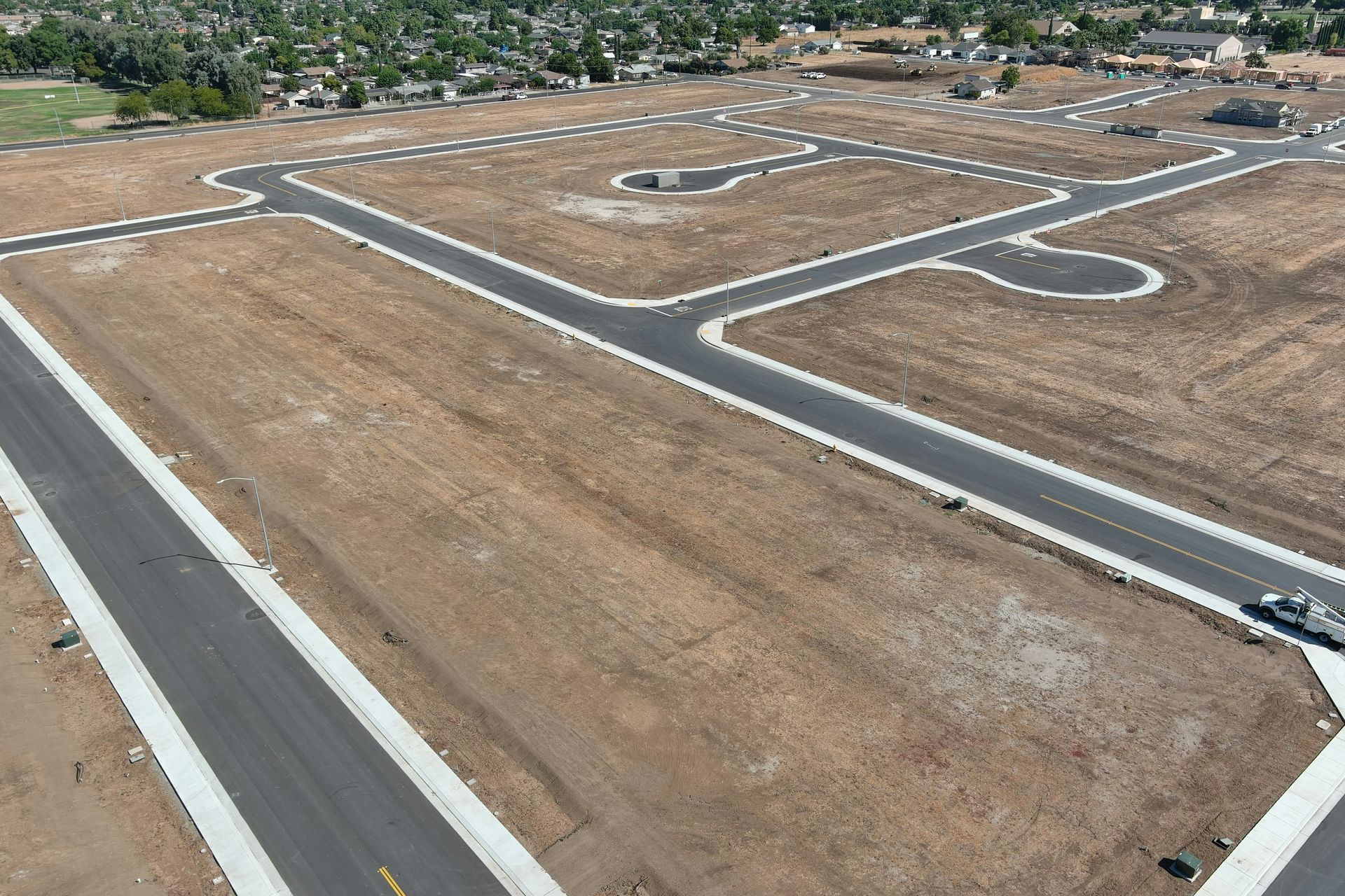
Drones can precisely measure cut and fill volumes.
Before the project, a drone can map the existing topography to create contour lines and a baseline model.
After excavation, another flight shows precisely how much material was removed (cut) and where it was placed (fill).
The software can create contour maps showing the changes.
This is critical for balancing a site and confirming contractor billing.
You can also track excavation volumes for features such as building foundations, retention ponds, or trenches.
Getting these numbers right is fundamental to the structural integrity and cost of a project.
Finally, it is used in mining and landfill management to track extracted resources or remaining airspace capacity.
Choosing the Right Drone Partner for Your Project
Getting great results depends on working with a qualified professional.
Not all drone operators have the specific experience needed for survey-grade drone mapping.
When you are looking for a company to provide this service, there are a few things you should look for.
Key Qualities of a Drone Photogrammetry Provider
| Criteria | What to Look For |
|---|---|
| Licensing & Insurance | FAA Part 107 Certificate and specific liability insurance for aerial operations. |
| Experience | A portfolio demonstrating successful projects in construction and earthworks. |
| Methodology | Consistent use of Ground Control Points (GCPs) for survey-grade accuracy. |
| Equipment | Professional drone hardware and high-resolution cameras suitable for mapping. |
| Deliverables | Clear, detailed reports with volume numbers, 3D models, and orthomosaic maps. |
Conclusion
The way we manage and measure materials on a job site has changed for the better.
Guesswork and slow, risky manual surveys are becoming a thing of the past.
The technology of photogrammetry offers a new level of insight.
Using drone photogrammetry for construction site volume calculations is now the practical, efficient, and reliable way to get the data you need to run a successful project.
You get faster answers, more accurate numbers, and a safer work environment for your team.
The data empowers you to make better, more informed decisions every step of the way.
By embracing this tool, you are not just getting better measurements.
You are gaining better control over your project's timeline and budget.

Ready to view your project from new heights?
Contact 1st Choice Aerials today to schedule your aerial photography, inspection, or thermal imaging service!